Písek, a picturesque city in the South Bohemian Region of the Czech Republic, is a hidden gem steeped in history and charm. One of its most notable landmarks is the Písek Stone Bridge, the oldest preserved bridge in the country. Built in the 13th century, this Gothic bridge spans the Otava River and is a testament to medieval engineering.
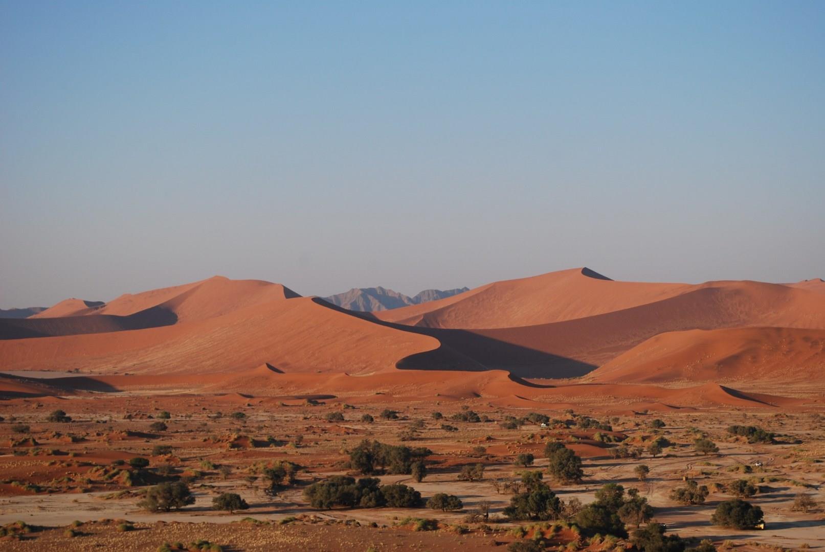
Sesriem, located in the heart of Namibia’s Namib Desert, serves as the gateway to the world-famous Sossusvlei and Deadvlei, two of Namibia’s most iconic landscapes. The dramatic red dunes of the Namib Desert, some of the highest in the world, are an awe-inspiring sight, particularly at sunrise when the light casts long shadows, creating an otherworldly contrast of colors.
Central Asia stretches from the Caspian Sea in the west to China and Mongolia in the east, and from Afghanistan and Iran in the south to Russia in the north, including the former Soviet republics of Kazakhstan, Kyrgyzstan, Tajikistan, Turkmenistan, and Uzbekistan.
Nunavut comprises a major portion of Northern Canada, and most of the Canadian Arctic Archipelago. Its vast territory makes it the fifth-largest country subdivision in the world, as well as the largest in North America.
Cusco is the South America's oldest continuously inhabited city, the gateway to Machu Picchu and once was the capital of the Inca Empire. Make sure you get to Plaza de Armas, the main square and center of the city. Walk through the nearby San Pedro Market to find a special gift for loved ones (or yourself!) or view the Sun Temple Coricancha.
Mozambique, republic in southeastern Africa, bounded on the north by Tanzania; on the east by the Mozambique Channel of the Indian Ocean; on the south and southwest by South Africa and Swaziland; and on the west by Zimbabwe, Zambia, and Malawi. Mozambique gained independence from Portugal in 1975. It has a total area of 799,380 sq. km (308,641 sq. mi). Maputo is the capital and largest city.
The country has a 2470-km (1535-mi) coastline on the Mozambique Channel and possesses several good natural harbors.
Two-fifths of Mozambique is occupied by coastal lowlands. Inland the land rises to the west in a series of low hills and plateaus to reach high points of 2436 m (7992 ft) on Mount Binga near the western border and 2419 m (7936 ft) in the Namuli Highlands in the north. To the northwest, forming the western edge of Africa's Great Rift Valley—here occupied by Lake Nyasa (Lake Malawi) and the Shire River—is the Angonia Plateau. Soils are generally infertile except along river valleys and in parts of the Angonia Plateau.
The country's many rivers flow from the highlands of the west to the Mozambique Channel in the east. Chief among these is the Zambezi River; its upper reaches form a lake behind Cabora Bassa Dam. Other major rivers include the Rovuma, which forms part of the Tanzania border, and the Save and Limpopo rivers. Lake Nyasa forms part of the Malawi border and drains south through the Shire River into the Zambezi River. Mozambique has a tropical savanna type of climate, with a dry season that lasts from April to October. July (winter) temperatures average 21° C (70° F) at Pemba in the north and 18° C (65° F) at Maputo in the south. January (summer) temperatures average about 27° C (80° F) along the coast and lower in upland areas. Average annual rainfall decreases from 1500 mm (about 60 in) in the north to 750 mm (about 30 in) in the south, although amounts can be irregular.